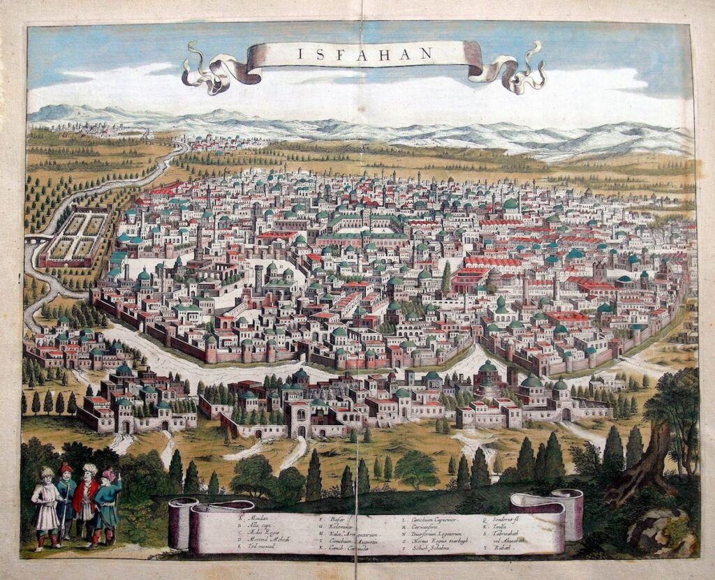
A stunning panorama of Isfahan, the capital of Persia in the 17th century, was created by Jan Janssonius and published in Amsterdam in 1657. This remarkable town view originally appeared in Janssonius’s rare eight-volume Theatrum Urbium, the most comprehensive Dutch town-book of its time.
Jan Janssonius (1588–1664), one of the most celebrated Dutch cartographers of the 17th century, lived and worked in Amsterdam. Renowned for his cosmopolitan perspective, Janssonius had a deep interest in portraying cities from diverse regions of the world, including Cairo, Algiers, Tunis, Constantinople, Damascus, and Isfahan.
He also produced several maps of the Persian Empire during the Safavid era, including a notable 1645 example that stands among the most famous works in Persian (Iranian) cartography.
ALSO WATCH: “Historical Maps of Persia” (An Interview with Cyrus Alai) – Produced by Persian Dutch Network :
ALSO SEE: “PERSIA” in Silk Road Exhibition of Amsterdam Hermitage Museum
Follow PERSIAN DUTCH NETWORK on Facebook | Instagram | Twitter | Telegram | Linkedin


